


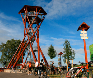
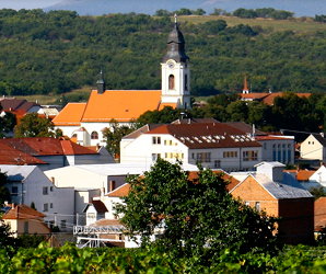
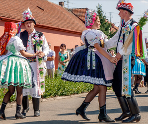
Trails going through the town of Velké Pavlovice
CYCLING TRAIL AROUND THE ANDRÉ DISTRICT
|
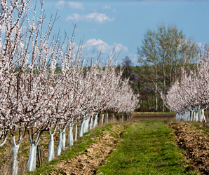
Accept our warm invitation to get to know one of the most varied wine-growing routes with many beautiful corners, non-repeatable views of wine-bearing country, also with interesting meetings with wine and people of this district. The route leads through famous vintner villages of the wine-growing district of Velké Pavlovice. A |
|
|
Variant I |
|
|
|
|
|
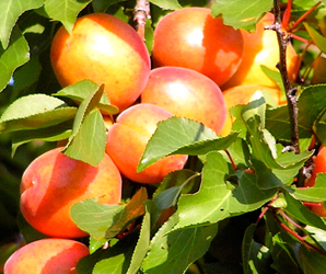
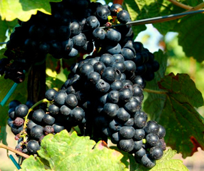
The explanation is simple - the attribute was chosen after the vine variant characteristic of our district, and the origin of this can be found in the very heart of the cycling trail– in Velké Pavlovice. It originated by the combination of the vine variants of Frankovka and Svatovavřinecké (St. Lawrence vine) by Mr Jaroslav Horák at the local wine-growing station. The variant of André is relatively demanding for a suitable location. A good André vine, however, produces harmonious wine with a more remarkable variant scent and intensive color. And these characteristics of high quality wines of |
;)
;)
|
WHERE TO OBTAIN TOURIST INFORMATION? |
|
|
|
|
|
|
|
|
|
|
|
ARE YOU COLLECTORS OF TOURIST STAMPS AND VIEWCARDS? |
|
|
Then we will really please you with a rich collection when you do our cycling route. You can collect the total of 4 stamps. TS No. 827 Vintner Village of Bořetice, No. 632 Town of Velké Pavlovice, No. 794 Town of Hustopeče, and an innovation is a brand new Annual tourist stamp on the occasion of the opening of the new tourist and cycling route called „Around André District“. You can obtain it in all above outlets where standard stamps are sold. |
|
|
|
|
;)
MORAVIAN WINE TRAIL
|
Moravian wine trail, passing through the town of |
;)
Trails in the Surroundings of Velké Pavlovice ...
MORAVIAN WINE TRAILS form an integral network of marked cycling routes in the area of all wine-growing districts in the South of Moravia. Each of nine wine-growing districts has a wine trail of its own, all of them join the spinal trail called Moravian Wine Trail from Znojmo to Uherské Hradiště.
The individual trails are named after the wine-growing district through which they run, and together with the spinal route, they offer to the cyclists many shorter and longer routes for short and long cycling trips. The visitors can choose what they like from the offer, for instance a one day trip through the vineyards and orchards along the Wine Trail of Velké Pavlovice, or the
The Moravian wine trails provide the real lovers of cycling trips with possibilities of going each of them separately.. This is the only way how to get to know the most beautiful vineyards, lanes of wine cellars, and historic sights of this wine-growing region. The wine trails are different from the standard cycling routes by the way they are incorporated in the countryside as well as by the method of their marking. The routes are winding through the countryside, being noticeable at first sight. They are not made in the straight line, but they lead the visitors to each of the landmarks, remarkable in the wine-growing landscape and with a special charm. The wine trails are especially designed for those who would like to familiarize with the local atmosphere and countryside.
The routes usually run along quiet roads of class III, very frequently along agricultural side roads, and in some places along roads in woods. The surface of the roads is usually fixed, only few sections are dusty roads. The routes are designed to be passable even after rain. You can get out on the wine trails by a road bicycle and you need not be afraid of any high hills and steep slopes. We recommend to less trained cyclists and to groups with children to first read the wine trail route map carefully, where enough information about the length of the route, its height profile and state of surface can be found. For families with children there are special marked sections in the map, where the traffic intensity is increased. A good preparation over the map can guarantee a feeling of delight and joy during the ride.
All the wine trails are marked with their common logo, each trail has a color of its own, such as that of Velké Pavlovice has blue, Znojmo trail green, trail of Uherské Hradiště violet. The logo of the wine trails in the particular color is placed on all direction signs, boards with maps, and information boards in villages. The routes are marked with yellow metal plates. In case of its parallel direction with the marked cycling route, its number is indicated. Information direction signposts with pictograms notifying about places of interest and services are near the route. In each village on the wine trail there is also a board with a general map of the wine trail. There are about two hundred and sixty cycling and hiking maps for good orientation on the trails. The information in the terrain is in some places complemented with boards with the description of local places of interest or a village plan with the indication of services. A detailed description of the wine trails is provided by a set of ten maps of the Moravian wine trails. The maps contain all other cycling routes, routes for hikers as well as the height profiles of the routes. A very useful aid is the graphic differentiation of the roads with slight traffic intensity, roads with heavier traffic, non-fixed roads with a good surface, roads with surface of difficult practicability, and also paths where motor vehicle traffic is prohibited. The creation of the road network designated for the cyclists only is a target for the future.
For further information please see the Wine Trail Guide in a book form. The edition of 1999 contains routes which were slightly different and which were not marked in the terrain those days, but the brochure provides plenty of useful information arranged according to the wine-growing districts with a survey of vintner events, wine shops, wine archives, list of cellars with telephone numbers of local vintners and VINITORIUM of Professor Vilém Kraus about how to choose, buy, store, taste, and with what to drink wine.
Within four years, the project authors from the Partnerství (Partnership) Foundation incorporated 220 vintner villages in the project, marked
SCHEDULE OF MORAVIAN WINE TRAILS AND WINE-GROWING DISTRICTS
Moravian Wine Trail-
Brno Wine Trail – in preparation (connection to Brno, middle blue)
Znojmo Wine Trail -
Mikulov Wine Trail -
Velké Pavlovice Wine Trail - 109 (light blue)
Wine Trail through Podluží -
Mutěnice Wine Trail -
Kyjov Wine Trail - 84 km (light green)
Bzenec Wine Trail -
Strážnice Wine Trail -
Uherské Hradiště Wine Trail -
Total